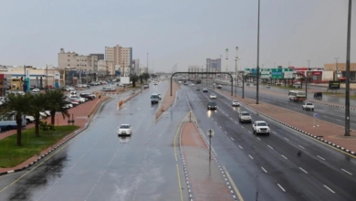
Today's weather in Saudi Arabia: Rain, cold waves, and winds
The National Center for Meteorology revealed in its daily report details of the weather conditions on Monday in the Kingdom of Saudi Arabia, indicating various weather fluctuations including thunderstorms, a noticeable drop in temperatures, and widespread surface wind activity that stirs up dust and sand.
Climatic context and topographical diversity
This weather pattern is typical of winter in the Kingdom, where northern regions are affected by cold air masses from the north, leading to a sharp drop in temperatures, while the mountainous terrain in the southwestern and western regions contributes to the formation of cumulonimbus clouds and rain. This geographical diversity in the Kingdom means it experiences multiple weather patterns simultaneously, necessitating continuous monitoring of weather forecasts to ensure public safety, especially for highway users and farmers.
Rainfall and cold wave map
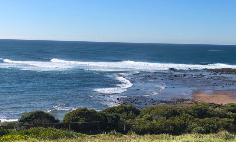
The weather report indicated that the chance of thunderstorms accompanied by active winds that reduce horizontal visibility remains high in parts of the Al-Baha and Makkah , with this effect extending to the southern parts of the Madinah highlands. These rains are considered vital for replenishing groundwater and vegetation in those mountainous areas.
In contrast, harsh winter weather prevails in the north of the Kingdom, with cold to very cold conditions persisting in parts of Hail, Al-Jawf, and the Northern Borders regions . The cold air mass extends its influence to include the northern parts of the Eastern Province. This weather pattern is accompanied by active surface winds that stir up dust and sand, also affecting parts of Tabuk, Madinah, and Makkah, reaching as far as the eastern parts of the southwestern highlands.
State of the Red Sea and the Arabian Gulf
Regarding the marine conditions, the report indicated the following wind and wave movements:
- The Red Sea: Northeasterly to northwesterly surface winds are expected in the northern and central parts, while southeasterly to southerly winds are expected in the southern part, with speeds ranging from 20 to 40 km/h, potentially reaching 50 km/h during thunderstorms. Wave heights are expected to range from 1 to 2 meters, and may exceed 2 meters during thunderstorms, resulting in a moderate to rough sea state.
- Arabian Gulf: Winds will be northwesterly to northeasterly at a speed of 20-40 km/h, with wave heights ranging between one and two meters, and a light to moderate sea state.
Special alerts for the Eastern Province
The Early Warning System issued a special alert for the Eastern Province regarding wind activity and blowing dust, beginning at 9:00 AM and continuing until 6:00 PM. The effects include reduced horizontal visibility and winds reaching speeds of 40-49 km/h in Jubail, Dammam, Khobar, Qatif, and Ras Tanura . Meanwhile, Al-Ahsa, Al-Udayd, and Abqaiq governorates are experiencing blowing dust that will reduce visibility to 3-5 kilometers, requiring caution while driving.