Saudi Arabia showcases its experience in geospatial maturity in Tunisia
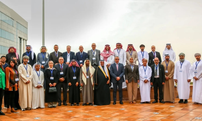
In a move reflecting its advanced international standing in the data and surveying sector, the Kingdom of Saudi Arabia reviewed its distinguished experience in measuring "geo-spatial maturity" during its chairmanship of the thirteenth meeting of the Arab Committee of United Nations Experts on Geospatial Information Management, which was hosted by the Republic of Tunisia.
The Kingdom was represented at this important regional forum by the General Authority for Survey and Geospatial Information , which led the discussions that continued over the two days of February 3 and 4, with broad participation from representatives of Arab countries and specialized regional and international organizations.
Saudi leadership in geospatial information management
This Saudi presentation comes at a time when the Kingdom occupies leading global positions in geospatial infrastructure indicators, reflecting the success of its national strategies aligned with Vision 2030, which places paramount importance on accurate data as a cornerstone of development planning. The Saudi presentation focused on the Kingdom's methodology for implementing international standards for measuring geospatial maturity and how it transforms spatial data into effective decision support tools serving various vital sectors.
Meeting agenda: Arab integration and international partnerships
The meeting, which is the highest-level Arab coordination platform in this field, discussed a range of strategic issues, including:
- Review of the annual report of the Arab Committee and the achievements of the specialized working groups.
- Discussion of the outputs of the "Geodesic Framework" team concerned with unifying spatial references.
- Discussion of developments in the United Nations' Integrated Geospatial Information Framework (IGIF).
- Strengthening "geo-spatial governance" mechanisms to ensure the quality and flow of data between member states.
Promising Arab experiences: Tunisia and Iraq as examples
The meeting witnessed a rich exchange of experiences, as the host country, the Republic of Tunisia, presented a detailed presentation on its adoption of the Integrated Geospatial Information Framework, reviewing its national geographic data infrastructure project, and the efforts made in the field of standards, training programs and specialized vocational training.
For its part, the Republic of Iraq presented its ambitious national plan for implementing the integrated framework, reflecting a growing Arab trend toward digitizing maps and spatial data. The sessions also included presentations on opportunities for international cooperation and partnerships that could accelerate knowledge transfer and the localization of modern technologies in the region.
The importance of the event and its strategic context
The importance of this meeting lies in its role as a link between national efforts and the global standards set by the United Nations Group of Experts on Geospatial Information (UN-GGIM). Geospatial information is no longer just traditional maps; it has become a "digital infrastructure" upon which countries rely for disaster management, urban planning, environmental protection, and sustainable economic development.
The Kingdom concluded its participation by emphasizing the need for continued joint Arab coordination, strengthening geospatial governance applications, and developing digital infrastructure, in order to ensure the provision of accurate and reliable data that supports decision-makers in facing future challenges and achieving comprehensive development in the Arab region.