Interactive maps of the Two Holy Mosques: Guiding visitors with 100,000 smart routes

A qualitative leap in serving the guests of God
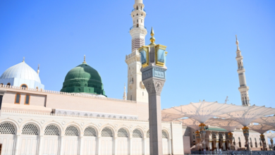
In a move aimed at enriching the religious experience and facilitating the journey of millions of Muslims worldwide, the General Presidency for the Affairs of the Two Holy Mosques announced the launch of the “Interactive Smart Maps” system. This advanced technological initiative represents a qualitative leap in spatial guidance services, providing more than 100,000 dynamic routes to guide visitors and pilgrims within the Two Holy Mosques and their surrounding areas, ensuring smooth and safe movement.
Historical context and ongoing efforts
This service is the culmination of the Kingdom of Saudi Arabia's decades-long efforts to serve the Two Holy Mosques and their visitors. Since its founding, the Kingdom has placed great emphasis on expanding the Two Holy Mosques and developing the services provided to pilgrims. With the increasing number of Hajj and Umrah pilgrims annually, logistical and organizational challenges have emerged in managing the massive crowds. Solutions have shifted from human guidance and traditional signage to adopting the latest digital technologies, in line with the objectives of Saudi Vision 2030, which seeks to enhance the Hajj and Umrah experience and leverage digital transformation to serve pilgrims in the best possible way.
Project importance and expected impact
The importance of interactive maps lies in their ability to provide real-time information and updated routes that adapt to changing conditions. Locally, the system will help reduce confusion and overcrowding, automatically guiding visitors to less congested routes, thus enhancing safety and comfort. Internationally, this project reflects the Kingdom's progressive image and its ability to utilize advanced technology in managing the world's largest religious gatherings, further solidifying its position as a leading Islamic destination offering world-class services.
System operation mechanism and features
Engineer Ghazi Al-Shahrani, CEO of the Authority, explained that the maps operate by feeding the operations rooms with live data from the field, allowing visitors to be automatically directed to the most suitable routes in cases of road closures or heavy congestion. The system includes more than 950 points of interest distributed across 13 service categories (such as ablution areas, prayer rooms, and health centers), and is supported by approximately 650 QR codes to facilitate access to information. Dr. Mohammed Al-Saqr, Executive Vice President of Digital Transformation, indicated that the pilot operation of the system will begin in conjunction with the holy month of Ramadan, integrating with color-coding and metric addressing systems, thus laying the foundation for a major development project extending until 2026.
Enhancing operational efficiency
The system's benefits extend beyond visitors to include operational teams at the Two Holy Mosques. The maps are designed to support highly accurate location-based reports, thus accelerating response times. Engineer Wahib Al-Mutrafi, Director of Business Solutions, confirmed that the new system will expedite access to electric vehicles for pilgrims using their ticket numbers via a smart platform, thereby enhancing the system's efficiency and improving the quality of services provided to pilgrims.