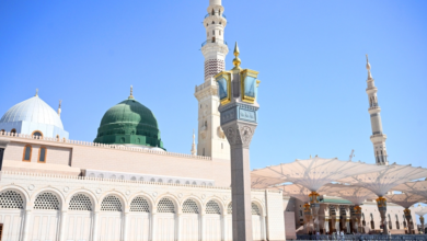
Interactive maps of the Two Holy Mosques: Smart spatial guidance for pilgrims
A qualitative leap in spatial guidance at the Two Holy Mosques
The General Authority for the Care of the Two Holy Mosques announced the launch of a smart interactive mapping system, a move representing a radical transformation in the spatial guidance services provided to millions of visitors and pilgrims. Engineer Ghazi bin Dhafer Al-Shahrani, CEO of the Authority, explained that this system constitutes a qualitative leap aimed at facilitating the movement of pilgrims and enhancing the efficiency of guidance within the Two Holy Mosques by providing real-time information and updated routes that ensure their safety and enhance the quality of their spiritual experience.
In the context of digital transformation and Vision 2030
This technological achievement comes as part of the Kingdom of Saudi Arabia's ongoing efforts to achieve the goals of Vision 2030, which prioritizes serving pilgrims. For decades, managing the massive crowds flocking to the Two Holy Mosques, especially during peak seasons like Ramadan and Hajj, has posed a significant logistical challenge. Today, the General Presidency for the Affairs of the Two Holy Mosques is harnessing the latest smart technologies and artificial intelligence to address these challenges, transforming the experience from reliance on traditional signage to a comprehensive digital system that provides dynamic and personalized guidance for every visitor.
System operation mechanism and smart integration
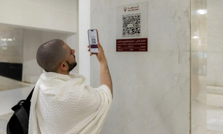
The interactive maps rely on a sophisticated digital system fed by live operational data from the central operations room. This direct connection allows the system to guide visitors to less crowded routes and avoid areas of temporary closures or high density. Dr. Mohammed Al-Saqr, Executive Vice President of Digital Transformation, noted that the pilot phase, launched during Ramadan, integrates with the "color coding and metric addressing" system, which divides the Two Holy Mosques into clear geographical zones, supporting smart operations and enhancing space management efficiency. The system currently includes more than 950 points of interest distributed across 13 service categories, supported by over 650 QR codes, with the technical capacity to generate more than 100,000 dynamic routes that are automatically optimized based on crowd movement variables.
Expected impact and importance of the project
The importance of this project extends beyond the local level to the international level. Locally, the maps contribute to improving operational efficiency and reducing the burden on field staff. Internationally, they enhance the Kingdom's image as a leading nation in utilizing technology to serve humanitarian and religious causes, and provide a model to be emulated in managing the world's largest human gatherings. Furthermore, the system supports location-based reporting and expedites access to services, such as electric vehicles, thus improving the quality of services provided to pilgrims, especially the elderly and people with disabilities, and making their spiritual journey easier and more comfortable.