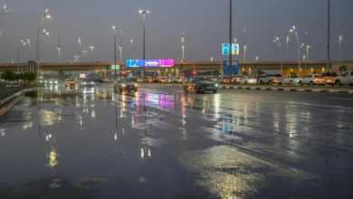
Saudi Arabia weather forecast for Saturday: Heavy rain, flash floods, and weather warnings
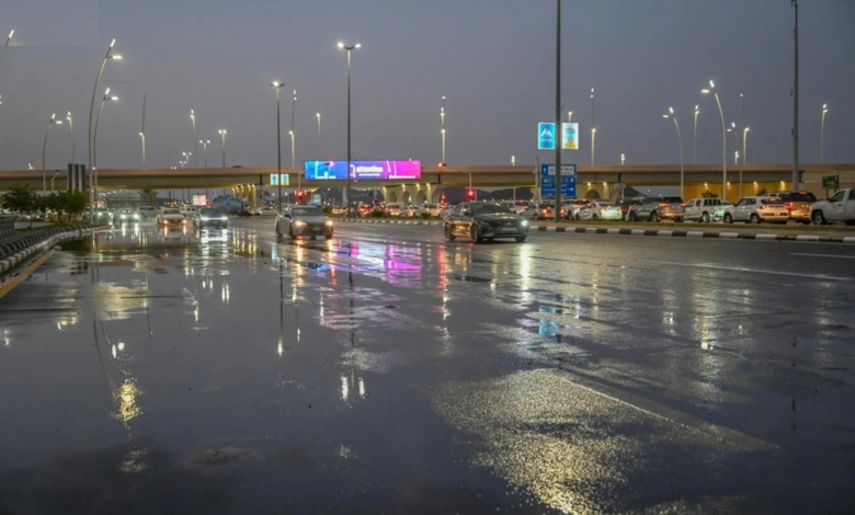
The National Center for Meteorology issued its daily report on the expected weather conditions on Saturday in the Kingdom of Saudi Arabia, revealing significant weather fluctuations including thunderstorms of varying intensity, ranging from moderate to heavy, accompanied by multiple weather phenomena that require caution in several regions.
Details of the rainfall situation and affected areas
According to the weather forecast, there remains a chance of moderate to heavy thunderstorms, which could lead to flash flooding in valleys and ravines. This weather pattern will be accompanied by hail and strong winds that will stir up dust and reduce horizontal visibility. The affected areas include:
- Parts of the Medina region.
- Al-Qassim region.
- Hail region.
- Tabuk region.
- Al-Jawf region.
- Northern Border Region.
- Eastern Province.
- The northern parts of the Riyadh region.
In contrast, parts of the Makkah and Al-Baha regions are experiencing light to moderate rainfall. The center also warned of the possibility of fog forming during the night and early morning hours, which could affect visibility in parts of the aforementioned regions, as well as the southwestern highlands of the Kingdom.
Climate context and the importance of warnings
These weather fluctuations are part of the transitional climate pattern that the Kingdom typically experiences at this time of year, as the region is affected by low-pressure systems that contribute to the formation of cumulonimbus clouds and rainfall. These forecasts are particularly significant given the Kingdom's diverse geography, with the northern, central, and eastern regions being affected by different atmospheric pressure systems than those impacting the southern and western highlands.
In such circumstances, the relevant authorities always stress the need to follow weather reports regularly and to stay away from flood channels and valley bottoms, especially in areas that experience heavy rainfall, in order to protect lives and property, as flash floods are one of the natural hazards that require a high level of community awareness.
State of the Red Sea and the Arabian Gulf
Regarding maritime navigation, the National Center of Meteorology provided details on wind patterns and wave heights in the Red Sea and the Arabian Gulf:
Red Sea
- Surface winds will be southwesterly to northwesterly in the northern and central parts, shifting to southeasterly and southwesterly in the southern part. Wind speeds will range from 20 to 40 km/h, potentially reaching 50 km/h with the development of thunderstorms.
- Wave height: It ranges from one to two meters, and may reach two and a half meters in the event of thunderstorms and rain over the northern and central parts.
- Sea conditions: Light to moderate waves, becoming rough in conjunction with rainy conditions.
Arabian Gulf
- Surface winds: They will be southeasterly to southwesterly, with speeds ranging between 20-40 km/h, reaching speeds of up to 50 km/h with the formation of thunderclouds over the northern part.
- Wave height: from one to two meters, reaching two and a half meters with thunderstorms in the north.
- Sea state: Light to moderate waves, turning rough in the northern part when thunderstorms develop.