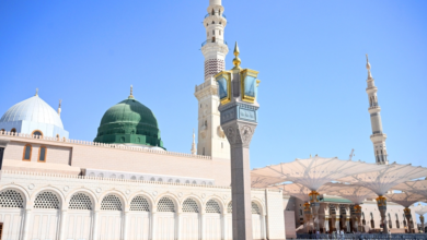
3D maps of the Two Holy Mosques: Accurate guidance for over 950 landmarks for pilgrims
A quantum leap in spatial guidance to serve millions
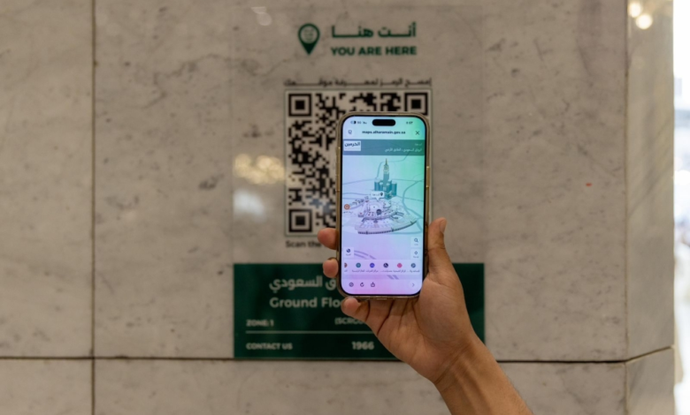
In a move aimed at harnessing the latest technologies to serve pilgrims, the General Authority for the Care of the Two Holy Mosques launched the advanced “Interactive Digital Maps” platform. This launch coincides with peak seasons such as the holy month of Ramadan, when millions of pilgrims and visitors flock to the holiest of places, making crowd management and facilitating their movement a top priority. This digital platform represents a true revolution in the concept of spatial guidance, placing more than 950 landmarks and service locations within and around the Two Holy Mosques at the fingertips of every visitor via their smart devices.
Part of the Kingdom's Vision 2030 to develop the Hajj and Umrah experience
This initiative falls within the framework of the Kingdom of Saudi Arabia’s ongoing efforts to achieve the goals of Vision 2030, of which the “Serving the Guests of God” program is a key pillar. Throughout history, the Kingdom has given paramount importance to serving the Two Holy Mosques, and the Two Holy Mosques have witnessed successive and massive expansions to accommodate the increasing numbers of pilgrims and Umrah performers. Today, digital transformation complements this developmental path, employing artificial intelligence, big data, and simulation technologies to provide a safe and accessible spiritual experience. The provision of such accurate interactive maps reflects the Kingdom’s commitment to enhancing the quality of services offered and promoting public safety in managing the world’s largest gatherings of people.
Advanced features for precise guidance in the Grand Mosque
The smart maps cover the entire geographical area of the Grand Mosque with pinpoint accuracy, encompassing all its vital facilities, from the circumambulation area (Mataf) and the area between Safa and Marwa (Mas'a), to the upper floors, the recent expansions, the basement, and extending to the surrounding courtyards and pedestrian entrances. The platform provides pilgrims and visitors with instant directions to prayer areas, cart pick-up and drop-off points, luggage storage, emergency exits, and the network of elevators and escalators. Most importantly, the platform utilizes realistic 3D models, supported by a color scheme that matches on-site signage, enabling visitors to accurately pinpoint their location within any floor or courtyard. It also provides real-time indicators of traffic density and movement, automatically guiding users towards less crowded routes.
Comprehensive facilities in the Prophet's Mosque
In Medina, interactive maps provide precise routes for visitors to the Prophet's Mosque, covering the Rawdah (the area between the Prophet's grave and his pulpit), the eastern and western expansions, the roof, and extending to the entrances of parking areas and tunnels. The platform clearly highlights the locations of services for the elderly and people with disabilities, as well as guidance points and support services, ensuring smooth movement and safe access to all mosque facilities. This technology reduces the time spent searching for services and prevents visitors from getting lost, allowing them to focus more on worship and their visit.
Local and international impact to enhance the experience of pilgrims
Locally, this platform enhances crowd management efficiency and reduces the likelihood of traffic congestion, thus increasing the safety and comfort of pilgrims. Internationally, this project offers a pioneering model that can be adopted for managing large gatherings worldwide. It also sends a clear message to Muslims everywhere about the technological advancements the Kingdom has achieved in providing them with the best possible experience during their spiritual journey, further solidifying the Kingdom's position as a leader in the Islamic world and a pioneer in utilizing technology to serve humanitarian and religious goals.